Contact Information: Click on "Home," email bob.busch.geotech@gmail.com, or phone 707-822-7300 (California) or 541-469-7300 (Oregon). Email administrative inquiries to marilyn@buschgeotech.com.alifornia), 541-469-7300 (Oregon), or 707-496-6700 (cell). Address administrative inquiries to marilyn@buschgeotech.com.
ABOUT THIS PAGE: I began posting to this page on 2/5/2014 and last updated it on 1/11/2015. The white number that precedes the photo title (in green capital letters) is the BGC job number. Some jobs contracted before 2014 and some much older jobs are still active today. Please visit the site as the year develops, and check out past year's jobs. Click on a photo to enlarge it. The orange text following the text gives a status report or UPDATE.
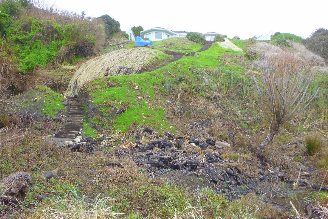
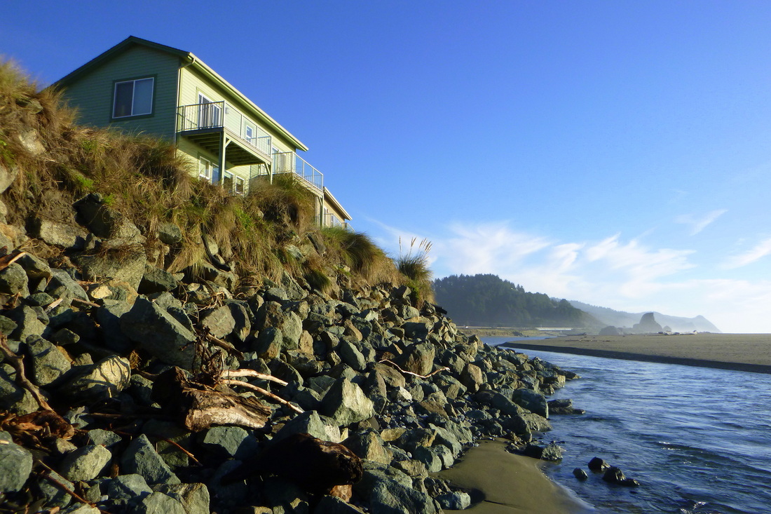
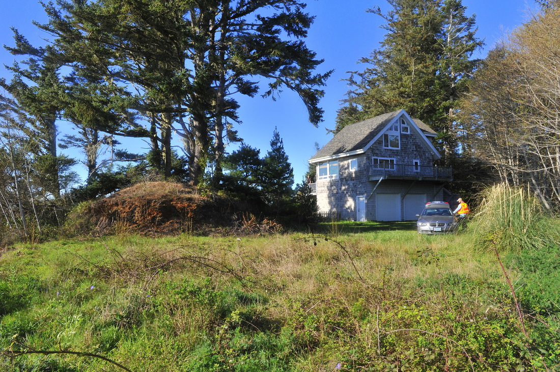
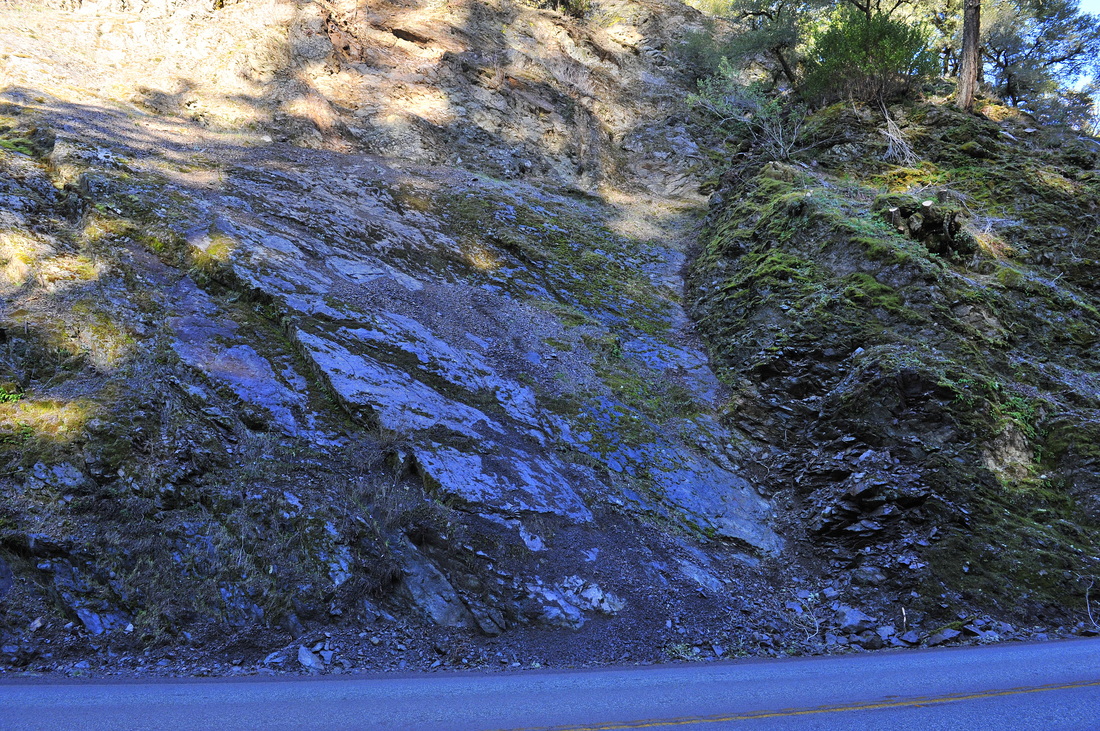
#14-044. A NEW KIND OF CLEAR-CUT. Our client cleared all of the native brush from the coastal bluff face and had workers build a fantastic set of railroad tie stairs down to the back-beach below. He responsibly took measures to control erosion by planting grass seed, strawing many of the seeded areas, and placing bird netting over the straw to hold it in place. However, because of the size of the cleared area, the city required a report from a professional, and he hired us. Because the hillslope is "stable" (moderately stable in our technical classification), his construction seemingly did not destabilize the slope, and the overall quality of the client's work was high, we did not have to make a survey-controlled map or write a lengthy erosion-control report or prescription. Instead we wrote a short report with several affordable, easy-to-complete recommendations. We understand the client forwarded a digital copy of our report to the City regulator, and everything now is in order.
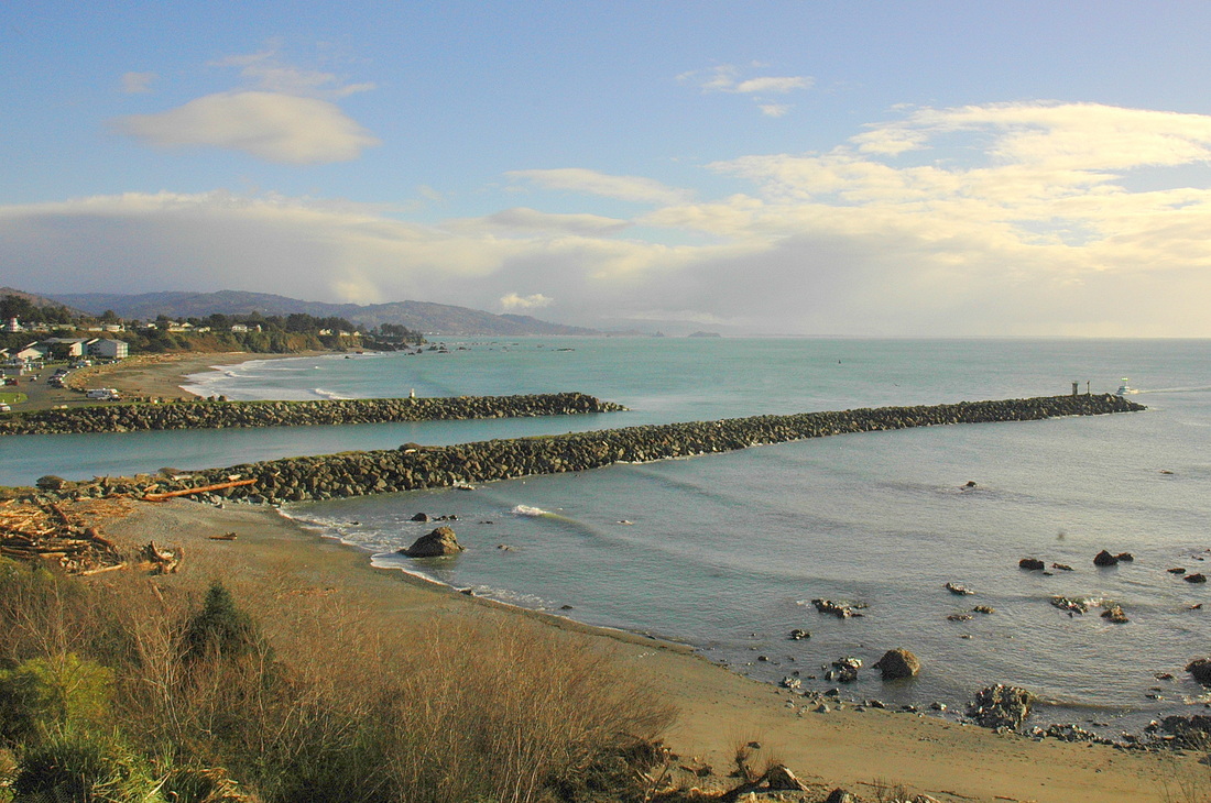
#14-044. Anudderwhataview! No wonder our client wanted to clear the brush. What a view from his back yard! The Mouth of the Chetco River.
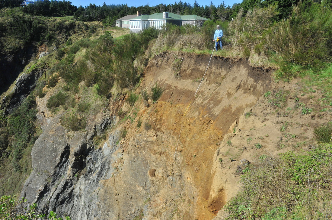
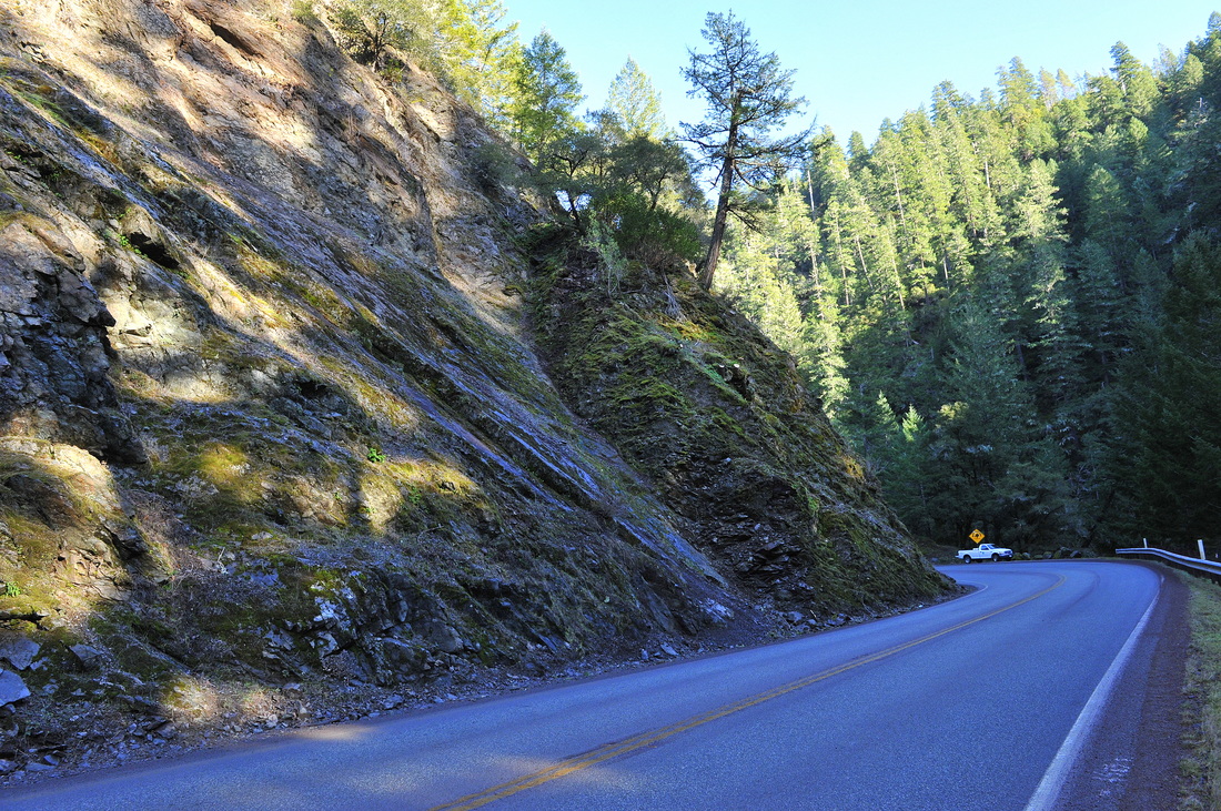
#14-043. OMG! You can't tell much from this panoramic photo. The geologic challenge was nearly as great. This is a possible (=desired) homesite on a bluff-top promontory west of Old Coast Road north of Wedderburn, OR (just past the Rogue Shores subdivision). The view to the ocean (photo left, highlighted out) is awesome. However, the slope behind the photographer is sliding into the inner gorge of a creek and the trees in this view are clinging to the edge of an unstable top-of-bluff. So there's lots for a geologist to think about here. The owners probably will move the proposed homesite back away from this area in response to our preliminary recommendations. We'll be doing follow-up onsite work in 2015.
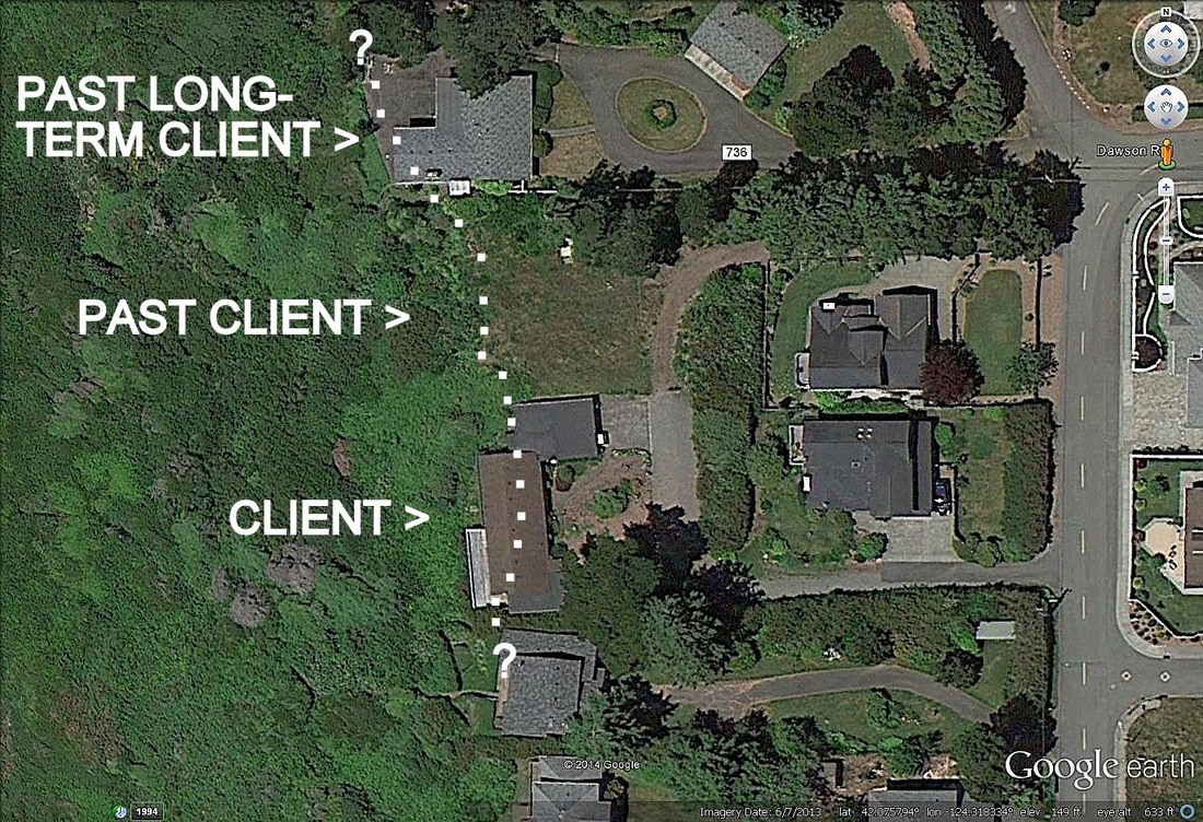
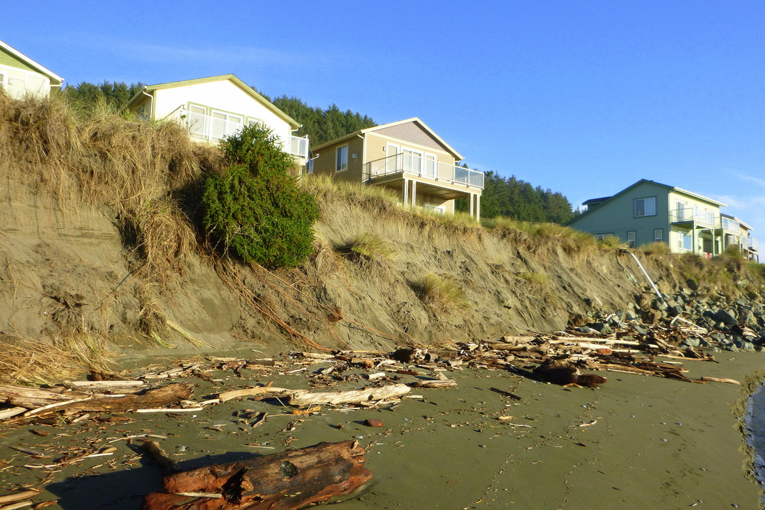
#14-041. THIS COULD GO IN THE BGC "OOPS" PAGE (if only because the original home owners in 1947 built across a "hill" that actually is a provisionally stable landslide scarp). This is a Google earth photo of an area east of Dawson Road in Brookings, OR. The white dots indicate the approximate west edge of the uplifted marine terrace. To grossly generalize, land to the east of the line is "stable" and land to the west is "unstable." We first evaluated the stability of the ground and condition of the home at the location labeled "Client" back in 1993 for the couple who eventually purchased the "Past Long-Term Client" property. We studied that northern property until recently when the elderly owner and long-time friend passed away (to our sorrow). Ground to the west (left) of the dotted line episodically moves downslope in response to marine undercutting and prolonged storms, generally failing as slump/earthflow. Our client asked us to evaluate the home and grounds and provide a setback assuming that she would tear down the existing home in two years and construct a new home. Our report provided several setback options, each tied to a different foundation-type / risk model. We do not yet know if our client has purchased the property.
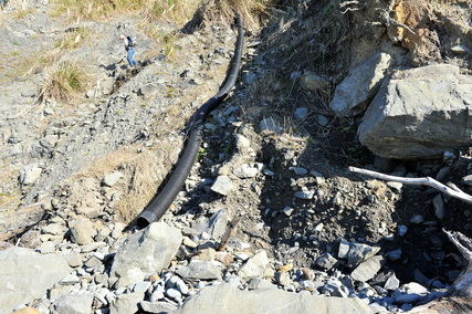
#10-025 (Inactive). TIME AND WAVES MARCH ON. Back in 2010 we monitoring the emergency installation of additional boulder rip-rap along a series of condominiums (Sebastian Shores) in Gold Beach, OR. The details are too lengthy (and convoluted) to go into here. The rip-rap did not extend northward past ALL of the units and by now, November 2014, the mouth of Hunter Creek has migrated past the end of the additional rip-rap. According to others, although the home owners developed an emergency contingency plan and stockpiled materials, something / some regulatory organization? has kept the work from starting. The next photo (below) shows the north end of the rip-rap and the at-risk sand bank. REB took these photos because of his interest in the problem; BGC is not under contract to evaluate any aspect of the situation. I.e., this is a human-interest post.
#10-025. SEBASTIAN SHORES CONDOS AT-RISK NOW. The condo just beyond (south of) the white PVC pipe is the dwelling in the photo above this one. Note the absence of rip-rap seaward of the three condos on the near side of the pipe. There is some rip-rap hidden by the sand (rip-rap the contractors buried in a trench in the sand) in front of those dwellings, but it wasn't installed correctly (old information) and it won't be enough to protect the structures from marine waves that can roll in the mouth of Hunter Creek and erode the dunes. Unless a contractor installs some type of effective protection quickly (BUT WHAT?), storms during the 2014-2015 winter could undermine these homes. Look up this area on Google earth. It is the southernmost complex on the back beach in Gold Beach, OR. UPDATE: The homeowner's association (?) was finally able to get permission from the appropriate State agency to install additional large rip-rap to protect the structures. We do not know if that "fix" is temporary or permanent.
#14-003 (and many job numbers more before). ONLY MATTHEW, MARK, & LUKE REMAIN. A Trinidad, CA, client of nearly two decades has progressively lost mature Doug fir trees she lovingly named, ones that cling to the top edge of the seacliff below her home. The following two photos will give you some idea why the trees episodically topple over the cliff edge (and a third shows something interesting in addition). We evaluate, via monitoring of sensitive in-ground devices, the stability of our client's yard both distant and near to her home. Work continues.
#14-003. HERE'S WHY. The downslope and north sides of the seaward-most tree are undercut by active landslides. The poorly consolidated late Pleistocene marine terrace sediments are failing in response to high rainfall events and the loss of "lateral and subadjacent" support as the Franciscan Complex (melange) bedrock itself fails. We established survey-controlled monitoring points on each tree. UPDATE: Between March and November 2014 the two trees highest on the slope (Mark and Luke) each moved 0.5 ft or a little more. We expect much greater movement over the 2014-2015 winter.
#14-003. A HEROIC EFFORT! NOT DYLAN; OUR CLIENT! Most owners of homes above a seacliff simply empty their residential drainage water at the highest possible point on the bedrock. Not our client. She discharges at the very toe of the slope. She has a maintenance crew regularly repair sections of drainpipe broken or displaced by ground movements, and every now and then we inspect the entire hillslope below our lowest monitoring station. The angular rocks are new to the beach; the subrounded ones have been there a while; the rounded ones have been residents the longest.
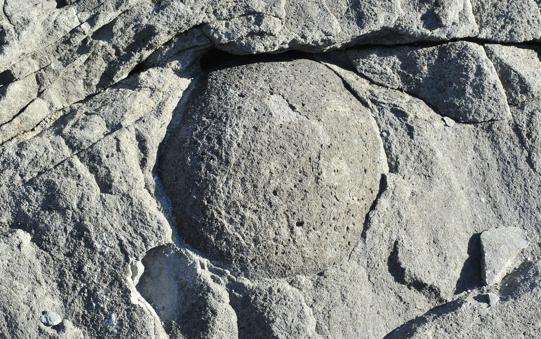
#14-003. WHATZIT? This cannonball size rock in a large boulder on the beach is a concretion, an area of the surrounding rock that preferentially received more of the cementing agent (here, silica). This one is incredibly spherical, but concretions can occur in a variety of shapes. We tried like the devil to free it from its prison using hammers and chisels, but t'was of no avail. The surrounding rock is as hard as, well, rock. That rock is a dense, poorly graded (=same size of grains) sandstone. Poorly graded sandstones are comparatively rare in the Trinidad area bedrock. Most sandstones are greywackes, rocks full of various sizes of sand composed mostly of lithic fragments rather than mineral grains. The rock in the photograph is mostly quartz grains, another oddity. Check out the next photo too.
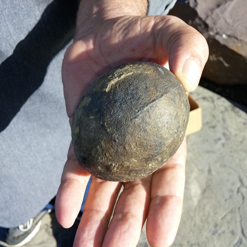
In-House Interest. WHATZIT #2? A grand old man--well, he's my age but happens to have a gorgeous head of white hair, unlike some of us--who on his daily walk passes by Tsunami Heights, BGC's Oregon office, brought this to me to analyze. I'm almost positive it, like the "cannonball" in the preceding photo, is a concretion. But the "seam" worries me, as do a couple of oddities on the "skin" of the thing. I need some locality data, and of course I should break it into pieces. But it's too cool to do that. Arvid should get it back in one piece. To be updated.

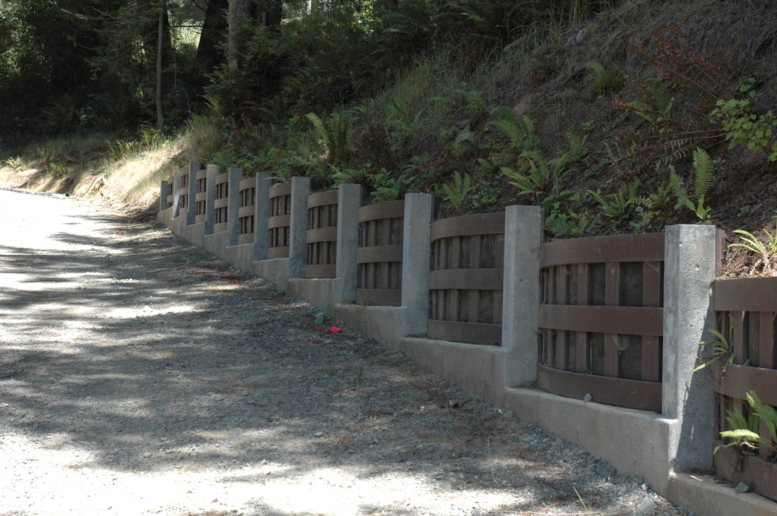
#14-042. A GABION RETAINING WALL. In 2013 a homeowner hired us to evaluate the stability of a landslide that an earthworks contractor had already attempted to stabilized. It didn't work. We recommended drainage- control measures and installing a gabion wall. A gabion is a rock filled basket made of galvanized wire. Generally a contractor constructs the gabions onsite. This wall is composed of two layers of 12-ft long 3 ft x 3 ft gabions filled with angular greenstone (altered basalt) cobbles. In addition to constructing the wall, the contractor removed the remnant landslide debris and pre-existing matrix-supported fill and replaced it with a rock-supported fill. It is the nature of the interlocking rocks that controls the risk of failure, rather than the plasticity of the matrix, so replacing the old fill was an intelligent move on the contractor's part. We inspected the construct and wrote a short report that provided our opinion of the work. The client is pleased.
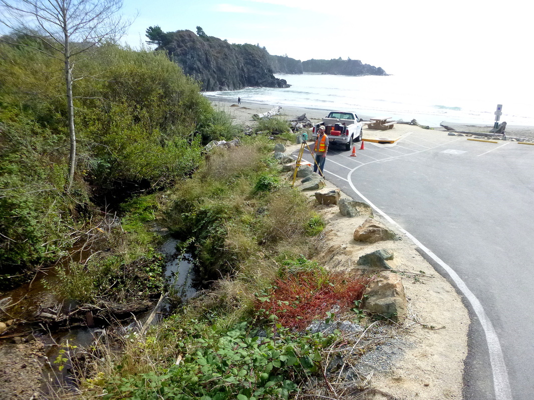
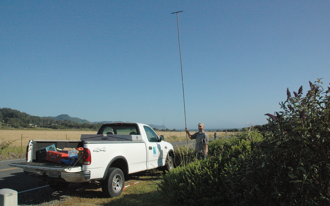
#14-034. WILL THE PARKING LOT SURVIVE ANOTHER HIGH DISCHARGE EVENT? In 2013, runoff from an exceptional storm removed up to ~4 ft of the channel bed of Maclyn Creek, deposited large woody debris in the channel, and undercut the right bank, putting the access road at risk. The city of Brookings hired us to recommend interim stabilization measures to protect the access road to the public parking lot until the City could complete a Corps of Engineer's permit and design a permanent structure. We made a survey-controlled topographic / geomorphic map of the meander bend and upstream approach (tied to local control provided by a licensed surveyor), determined the geology of the banks, and developed a remediation plan that will reduce the chance that the at-risk creek bank will be undercut more by a design flood event. We will deliver our report to the City by October 27th. And P.S. What a place to work!
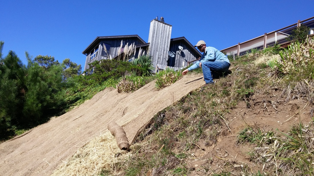
#14-036. A RAVELING, BOOMER-INFESTED HILLSLOPE. A homeowner got tired of looking at a raveling, bare to sparsely covered rocky slope above her home so hired us to develop a low-cost erosion-control plan (the stability of the hill was not at issue). We seeded the slope with the local erosion-control seed mix, added wildflower seeds to the mix, straw-covered the seeded slope, and then staked jute netting down to prevent a high wind from scattering the straw and seed. Finally, we set up two sprinklers above the slope and religiously watered for about a week. And, SUCCESS! The seeds sprouted after about a week. Young blades are poking through the netting. I'll add a photo when the slope is in full cover (and maybe full bloom). Right now it has to make it through the coming 2014-15 winter. We're still trying to figure out what to do about the boomers.
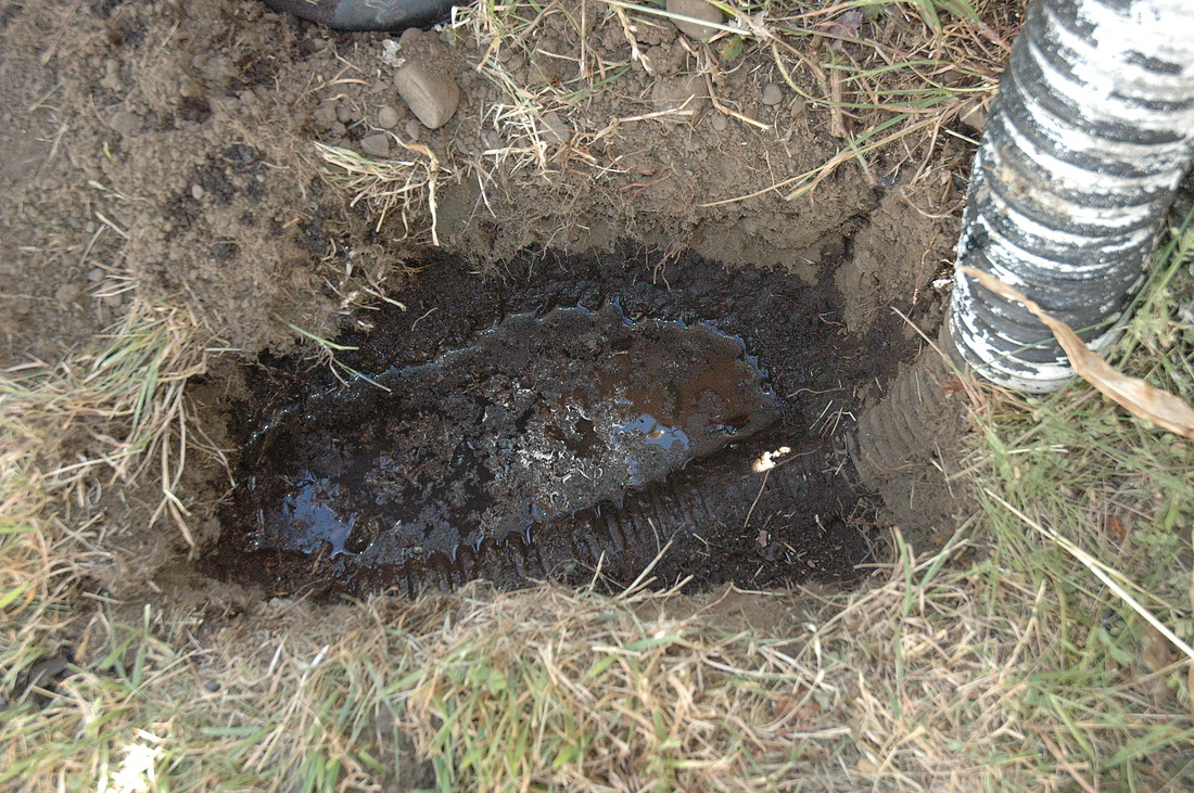
#14-025. PLUGGED DRAIN. A client from 2013 (#13-020, q.v.) purchased the property (with the awesome view) and planned a small addition to the decades-old home. The city (Brookings, OR) required a foundation-soil study and a drainage-control evaluation as part of the permitting process. We hand-dug holes beside the existing foundation to determine its embedment depth and footing width and what it bears on (topsoil). As part of our water-control evaluation we dug out the head of the drainage lines then put water down them. More than one line ponded water in our hole, indicating a plugged line. We issued a report that recommended design parameters (bearing value, footing width, and embedment depth) as well as repairs and changes to the existing drainage-control system. The project engineer followed our recommendations and signed off on our drainage-control recommendations and the City approved the project. (In Oregon, an engineer registered in the state must do a drainage-control plan or sign-off on one done by another party.)
|
#14-025. TYPICAL FOUNDATION EXCAVATION TOOLS: a shovel, hand-augur, hand scraper, measuring tape, Munsell color guidebook, soil log forms, and field notebook (not all shown).
|
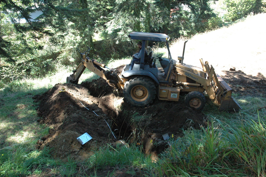
#14-028. BUILDING IN A HOLE IN A CLIFF FACE! Our clients purchased a lot that geomorphically is a re-entrant or hole in an otherwise linear bluff face north of the Rogue River in Gold Beach, OR. (The hole is an ancient drainage head, not a slope failure scar.) To help them, their designer, and the project engineer decide how, exactly, they could build on the site, we hand-augured multiple deep boreholes on the lot, determined the stratigraphy (soil layer pattern), and wrote a report to support the engineering design and building permit application. This was one of the most difficult sites we've worked on, largely because the depth of the hole and the difficulty of economically fitting a home on it while remaining in compliance with property line setbacks and the need to construct the home as far seaward as possible to preserve the view. We'll update later. See following photo.
|
#14-028. ONE DEEP AUGUR HOLE. Our boreholes revealed primarily fine sand strata: variably silty sands, clean sands, heavy mineral-rich (black sands), rare well-graded sands with fine pebbles, and partially cemented (oxidized) sands.
|
#14-031. LET'S NOT BUILD ON THIS FILL. A Brookings, OR, couple hired us to help them get the city's "Red Tag" off their property. We evaluated the stability of about 1000 cy of mixed fill soils a contractor gave them for "free" and placed on a hillslope above a creek. We made a survey-controlled topographic / geomorphic map of the filled area and its margins, dug test pits to determine what kind of fill went onto the ground and how the contractor placed it, and then we wrote a report that provided stabilization and erosion-control recommendations. The City removed the Red Tag and the homeowners hired a contractor to stabilize the fill and reduce its erosion potential. They never intended the fill to be a structural fill (to support homes, for example).
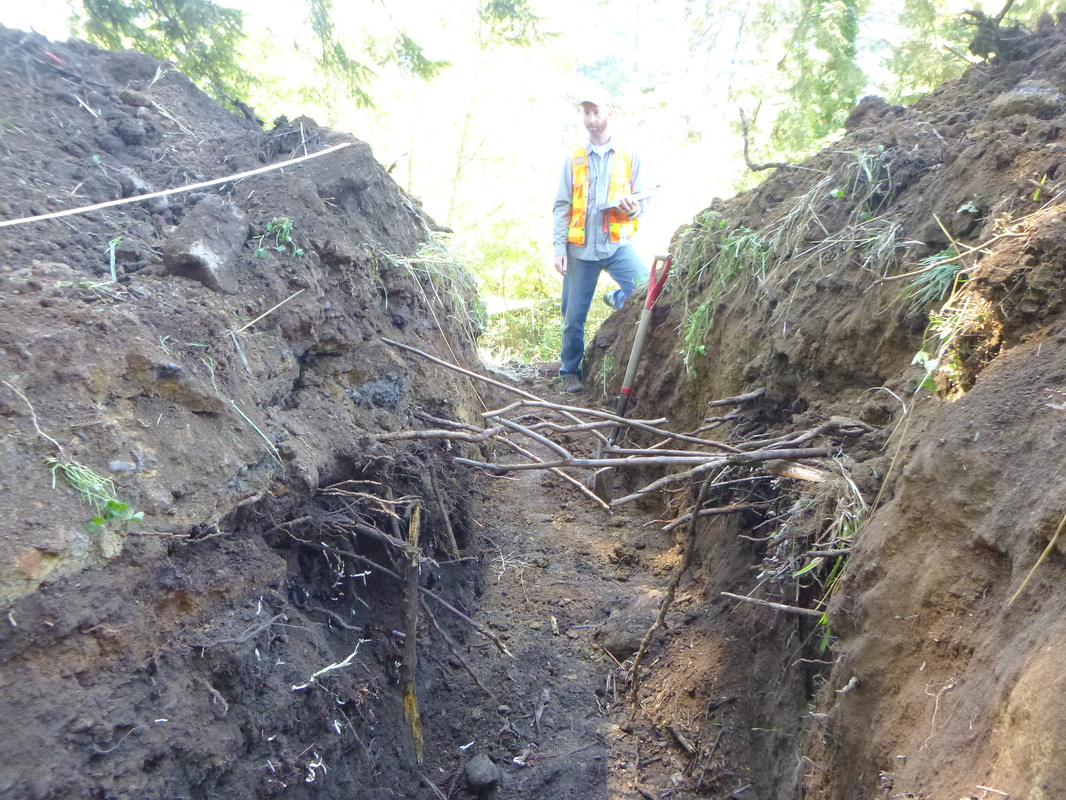
#14-031. Here's what some of the worst fill looked like when we exposed it in a backhoe trench. Here is a highly organic topsoil-based fill covered by a mass of clayey sand. This area of the fill mass contained pull-apart cracks and settlement features.
#12-008. A BEAUTIFUL ENTRYWAY WALL. Our client of many years is on the home stretch of his subdivision in Arcata, CA. This is his entryway wall, a combination retaining and landscaping wall. We monitor phases of road construction throughout the year.
#14-005. HERE COMES A MANSION! The buyer of this top-of-bluff, ridge line property north of Ophir, Oregon, and south of Sisters Rocks plans to construct a ~5,000 sq ft, two story home on the small triangular area in the foreground. We will be surveying the area to accurately map its edge, digging backhoe test pits to be certain that the ground was not broken by scarps before the sellers graded the area flat, and using a drill rig to establish the depth to competent soils. Because the oceanside slopes are active debris-slide slopes, we suspect that the home will have to bear on deep reinforced cast-in-place concrete piers. We completed a preliminary assessment, verbally presented it to the buyer, and now are waiting to do a site-specific geotechnical investigation. The next photo shows the view to the south from the edge of the building pad. The view to the north is just as spectacular.
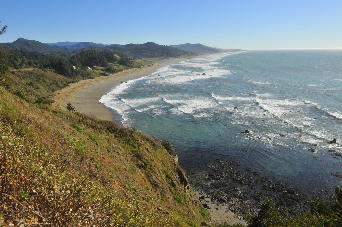
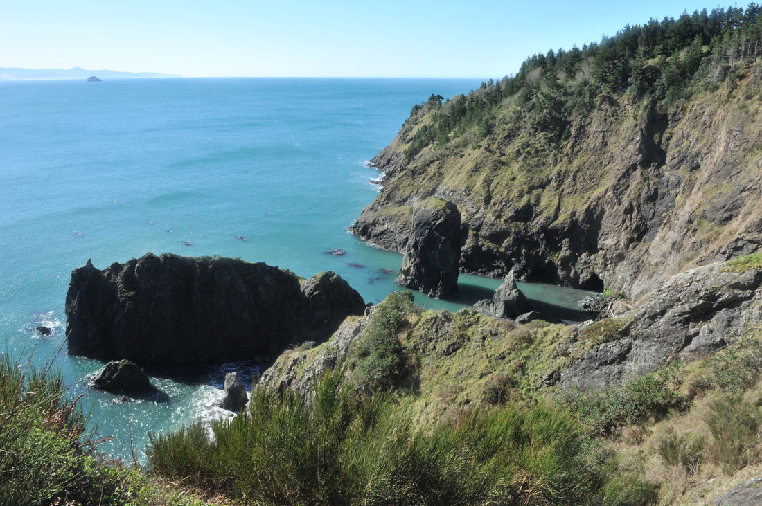
#14-005. WHAT A VIEW! And the beach below ends in tide pools that back up an arch in bedrock.
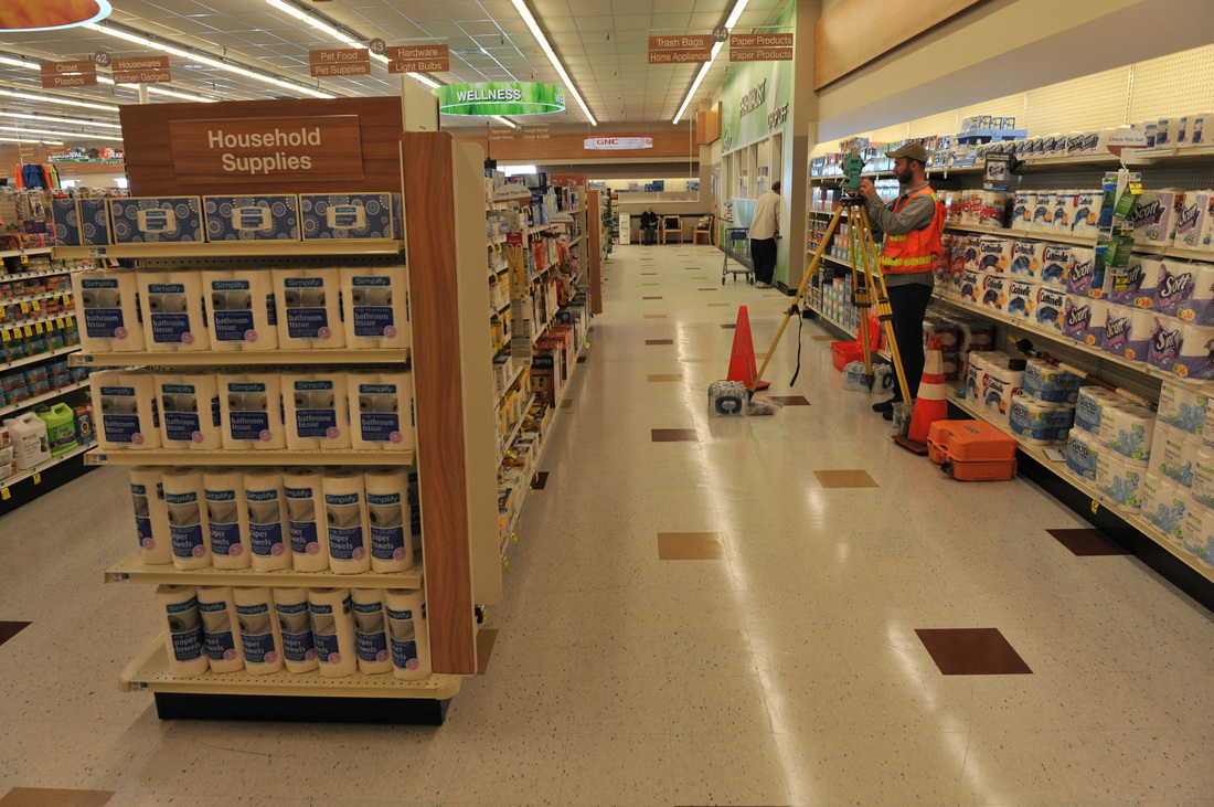
#13-027. JUST HOW MUCH OUT OF LEVEL, and WHY? As part of our on-going effort to understand why a slab in a commercial building in Harbor, OR, is developing a large elliptical depression we used a total station to survey the affected portion of the floor. The floor is enough out of level that shopping carts left standing will gallop off down an aisle. Surveying allowed us to quantify the amount of settlement and determine the azimuth of the axis of the depression. The axis parallels the alignment of a deeply buried culvert that passes under the building, suggesting that the culvert might be rusted out and soil piping during high discharge storm events is removing support from the slab floor. We might bring a portable drill rig into the building to explore the subsurface. An engineer working on the problem will be using video surveillance to inspect the inside of the culvert. The owners of the building are deciding what to do with the information.
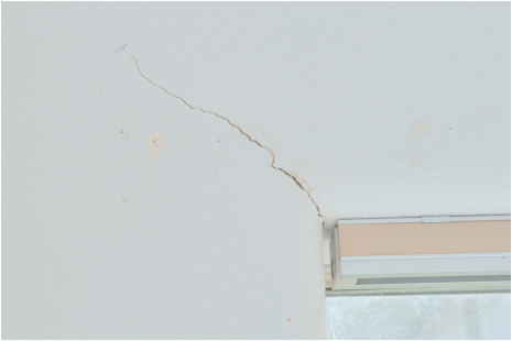
#14-009. IT'S JUST A LITTLE CRACK. The owners of an apartment contacted us to explain why some of the walls were cracking and why windows were out of square and the sills and kitchen counter were out of level. We completed an inspection of their living space and the building foundation below, provided verbal discussion, and then wrote a letter for them. The photo below shows crack monitors epoxied across cracks in the foundation.
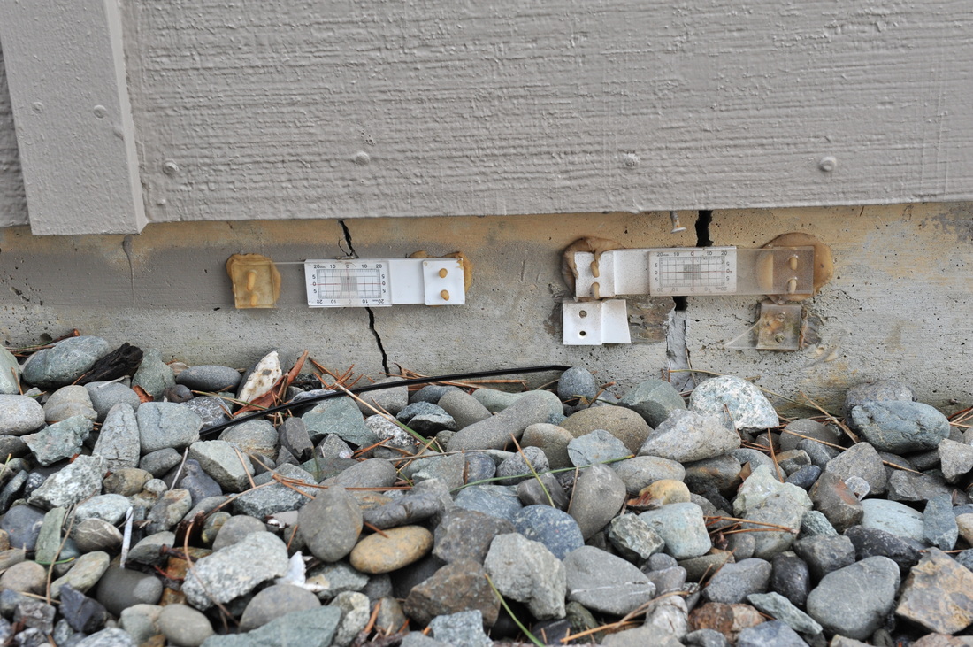
CRACK MONITORS. These plastic devices can track the widening of a crack. The two sides of the monitor can move independently, so as a crack widens, the cross hairs on the upper plate track the movement.
#14-010 & -011. WHOA NELLIE! A client wants to build as close as possible to the edge of bluff on this Port Orford, Oregon, lot. The stratigraphy is ~5 feet of topsoil grading to older reddish-brown topsoil grading to yellow-brown subsoils derived from the late Pleistocene Indian Creek marine terrace. The slope of the top of the cliff face in this photos is not indicative of a stable slope. We did a geotechnical realty disclosure report for the seller and extra subsurface work for the buyer. UPDATE: The buyer completed the purchase and we returned to do detailed subsurface work to calculate a reasonably safe setback. We completed a geotechnical report and erosion-prevention sediment-control (EPSC) report that the client delivered to the city. The next photo is one of the spectacular views from the lot.
#14-008. There is a 10-ft-high scarp about 20 ft from this bluff-top home on Allen Lane in Brookings, OR. However, the scarp exposes conglomerate (photo below), which is comparatively strong and can hold a near-vertical face for many years to many decades. In some cases it fails as a "block topple." Gravity causes a crack to form back within an outcrop 3 or more feet. Over time, the crack widens, decoupling the block from the rest of the outcrop. Over time the crack fills with topsoil and eventually the block topples over (falls off the outcrop face) or slides down the slope. We inspected the site and issued a report to a potential buyer, assigning a low risk of damage to the home from future block failures of the conglomerate. The potential buyer became the buyer.
#14-008. A PERFECT MODEL.
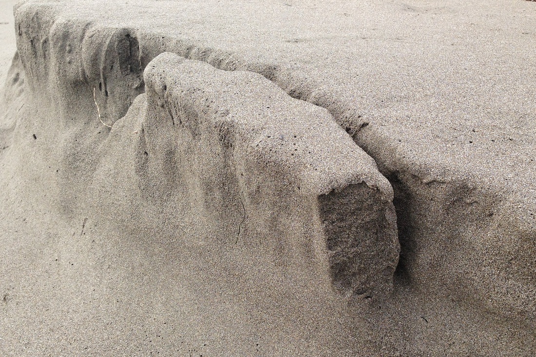
This decoupled block of sand on a beach in Brookings, OR, models a block topple of a marine terrace seacliff. In response to gravity, the mass of sand is beginning to lean outward and pull away from the face. Bluff faces--like the one at location #14-007--fail like this.
This decoupled block of sand on a beach in Brookings, OR, models a block topple of a marine terrace seacliff. In response to gravity, the mass of sand is beginning to lean outward and pull away from the face. Bluff faces--like the one at location #14-007--fail like this.
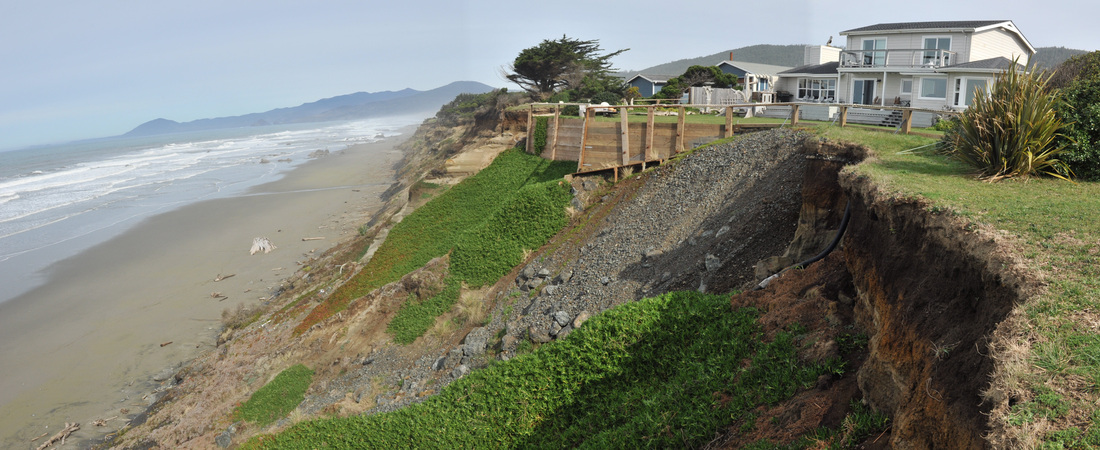
#14-007. AFTER. We were hired by the co-trustees of a Nesika Beach, OR, property to evaluate the risk to the property and to estimate (calculate) the home's possible lifespan, then issue a geologic realty disclosure report to support the sale of the property. This is a current photo of the edge of the bluff on our clients' lot, looking toward the property to the north (our client's home is set back about 90 ft out of view to the right). The photo below is the same approximate view taken in 2006 (note the green bush on the right). Report issued. The property is for sale.
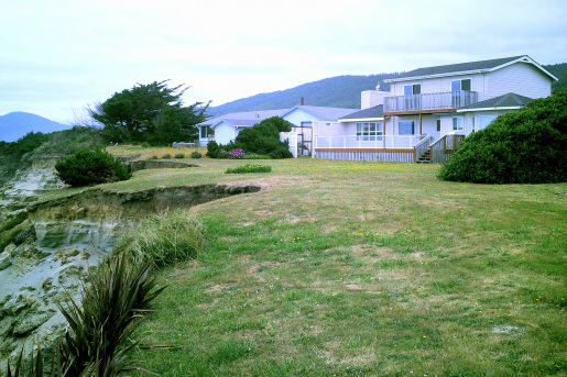
#06-063. BEFORE. In 2006 the elderly owners of the Nesika Beach property hired us to write a geotechnical disclosure report to help them sell the property. We calculated the probable economic lifespan of the home, the level of risk to which it was exposed, and issued a report. Then they decided to remain there, eventually passed away, and the family trust became the new owner. In 2014 the co-trustees hired us to update the original report with the latest erosion-rate, sea level, and seismic setting information. This is a photo of the adjacent lot to the north, which is suffering chronic rapid-rate erosion that threatens our clients' home more than the erosion on their own property.
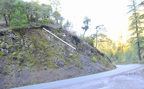
#13-026. AROUND THE CORNER IS A DIPSLOPE. An environmental attorney hired us to review Caltrans' proposed modifications of specific sites on Highways 197 and 199 in northern California. The modifications are to allow larger, longer trucks to more safely travel the roads. Both roads are in the wild and scenic (protected) Smith River drainage. This photo shows dipping Jurassic Galice Formation slates and metasandstones. Around the bend, 199 partially undercuts the slope. Caltrans plans to cut further into the slope to broaden the corner. The question is, more or less, "Will the widening lead to unexpected large or unending slope failures of the colluvium mantling the dipping beds?" (Note: the white line and > show the apparent dip of the beds. The true dip is more toward the road around the corner.) A judge placed an injunction on the project pending the submittal of additional information by Caltrans. See next two photos.
#13-026. A JOINT PLANE. We took this photo slightly east of the photo above. This is NOT a dipping bed surface but a dipping joint plane (one of several of different paired sets with different orientations). The rock that once was on top of this joint slid off. The same joint orientation exists around the corner (to the east) so cutting into the hill might trigger larger-than-expected slope failures. We'll update.
#13-026. A JOINT PLANE, 2. End-on-view of the joint plane in the preceding photograph. This photo makes the danger of excavating into the rock (thus undercutting a slope containing this joint set) quite clear. We'll update.
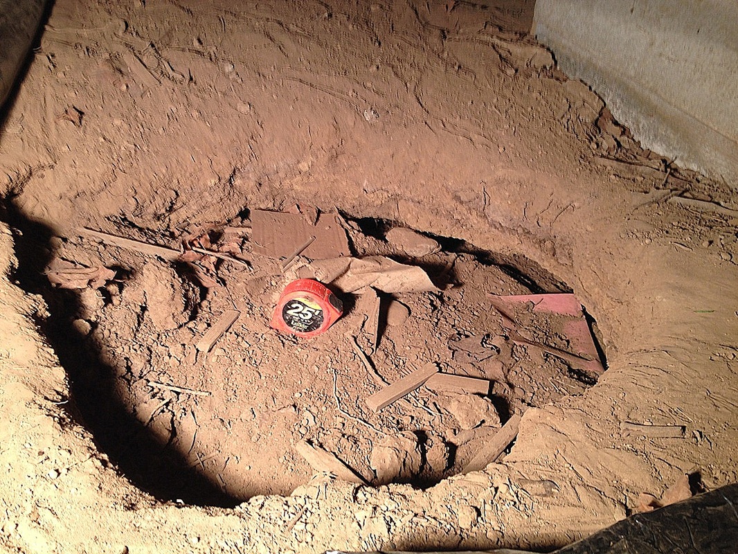
#14-001. WHEN IS A HOLE NOT SIMPLY A HOLE? Answer: When it is a bizarre settlement feature caused by the collapse of a buried burn pile / garbage dump! Our client needed to know the cause and significance of a hole discovered under her home by workmen. It turns out that the hole is a sinkhole--not the kind that forms in limestone terrane or as a result of a soil pipe collapse in a marine terrace setting--but one formed when buried garbage, wood debris, and ash from a burn pile consolidated over time (~60 years!). The hole is much bigger than it looks. It extends nearly halfway beneath the 2x2 ft sq concrete pier block (top right) supporting a main beam that in turn supports floor joists (there are no isolated interior supports for the floor). Our client filed an insurance claim, but the company denied it. She had a contractor fill the hole with crushed gravel. See photos below.
#14-001. PROOF POSITIVE. Here's an intact old bottle (see following photo) from about 3 ft in depth in the hole. We also recovered woody debris, charcoal, ash, broken glass, and other cultural (anthropomorphic) debris.
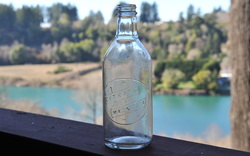
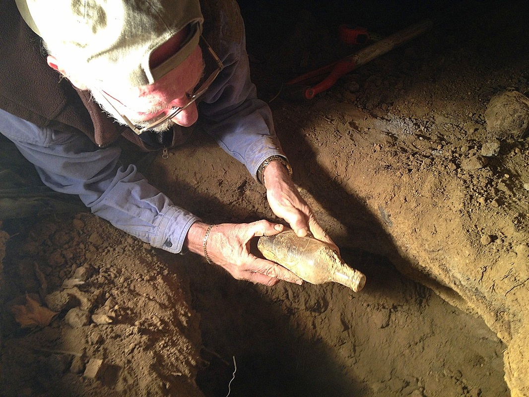
#14-001. A LAXATIVE BOTTLE! Here's the bottle recovered from the buried garbage / burn pile. How appropriate, given the crappy nature of the problem! Circa 1950 or before, we think. Ebay has them for sale, cheap.
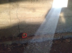
#14-001. A RAY OF LIGHT ON THE PROBLEM. This foundation crack is in the same home (there are several others). Because the crack is widest at the bottom, it means the foundation has deformed downward in response to consolidating soils underneath. We're guessing that either deep topsoils or more garbage / burn pile debris underlie the foundation at this location. The insurance company hired a different consultant who found about two feet of "soft" soil below this part of the foundation.