Alquist-Priolo Fault Investigations For subdivision lot layout in compliance with the AP Act of 1972 (CA) For road and utility corridor layout to maximize the number of lots
Analysis of Sequential Stereographic Aerial Photos To provide a chronologic history of landslide events To document the development history or construction activities To support arbitration or litigation
Basic Geologic Research To map geologic formations To map soil types To determine quarry rock and overburden suitability and volume
Borehole Logging / Cone Penetrometer Logging To support quantitative (FOS) slope stability analysis To facilitate liquefaction potential analysis To provide soil bearing information To indentify water-bearing zones To facilitate slope monitoring with inclinometers
Bridge Abutment Foundation Evaluation To support engineering design
Cell Tower Siting Studies To document subsurface conditions and soil strength To provide design seismic accelerations To provide site stability assurances
Crack Analysis, Mapping, and Monitoring To determine geotechnical causation To assess the structural significance of the cracks To assess the risk of additional cracking and structure failure
Damage Evaluations (Earthquake, Landslide, Flood) To support insurance companies' assessments
Erosion Control Prescriptions
Erosion Rate Studies In view of global sea level rise rates / acceleration To determine appropriate setbacks To minimize (or quantify) risk
Geologic Hazard and Risk Evaluations
Geomorphic Mapping and Analysis
Groundwater Evaluations For rural subdivision feasibility studies
Guest Lectures (e.g., for Real Estate Seminars)
Interactive Work with Engineers, Architects, Designers Synergetics at work
Laboratory Testing (Soils only; limited capability) Please ask for our lab capability We subcontract some tests to Cooper Testing Laboratory
Landslide Mapping and Risk Micro-zonation Landslide Stabilization Design Support for Engineers Liquefaction Potential Analysis Literature Review / Critical Analysis / Summaries Litigation and Arbitration Support Oblique Aerial Photography (35 mm) Photogrametrics Planning Support (e.g., Ordinance Development) Project Feasibility Investigations Quarry Stability and Compliance Monitoring Resource Management Support Road Alignment and Stability Evaluations Subdivision Studies and Reports Septic Disposal System Evaluation and Design (CA) Slope Monitoring with Inclinometers, Tiltmeters, Grids Studies for Water Lines, Storm Drains, Utilities Timber Harvest Plan Geologic Elements Topographic and Geohazards Mapping Water Tank Foundation Materials Assessments
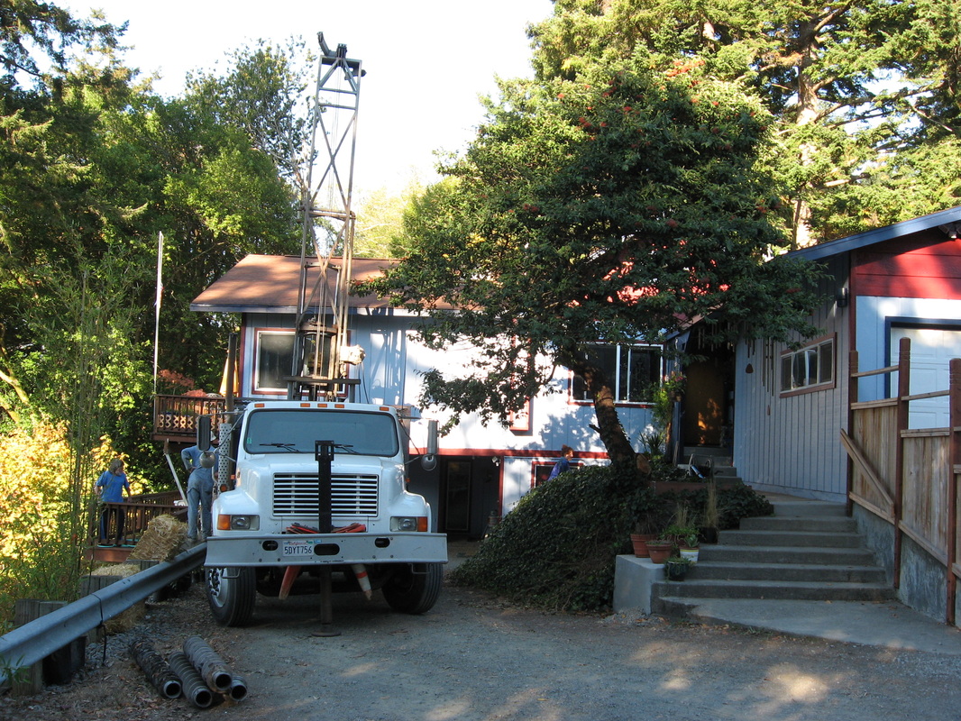
Drilling to set a slope inclinometer at the head of a landslide, South Bank Chetco River Road, Brookings, Oregon
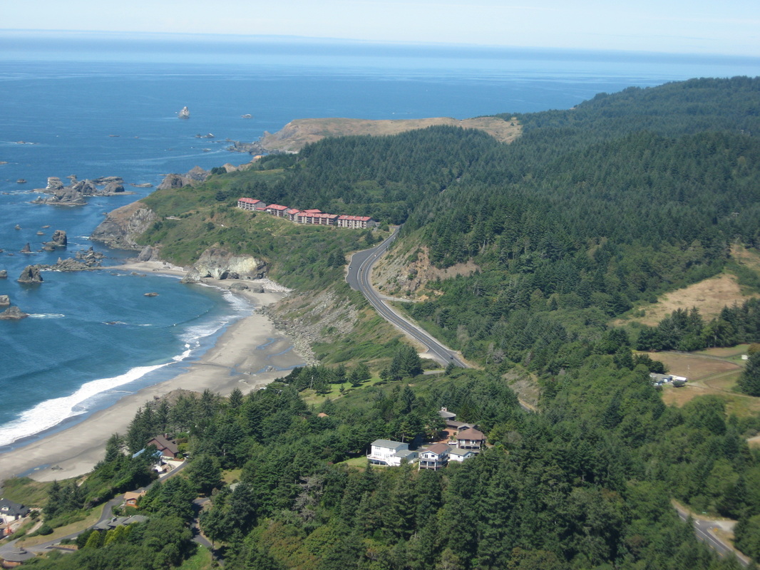
Aerial view of the Rainbow Rock Condominium Complex just north of Brookings. Stability evaluations are essential for development activities in this strand of coastline.
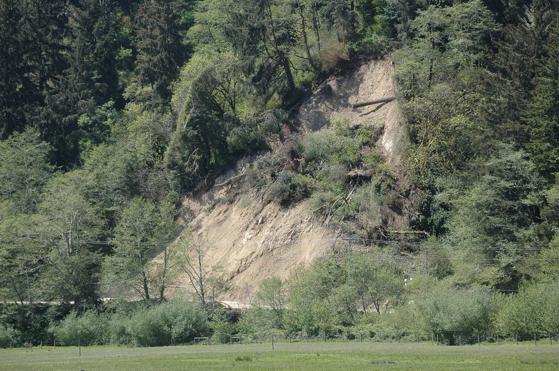
A debris slide along Requa Road, Del Norte County, CA, triggered by a high-rainfall event. This slide closed the road.
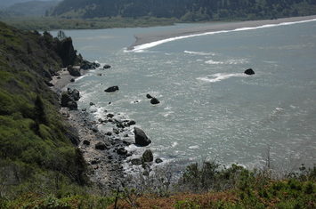
The Mouth of the Klamath River, Del Norte County, CA.